NASA’S TRILLION DOLLAR TREASON


NASA is nothing more than a masonic, occult and deeply satanic deception operation. It was founded by and run by Satanic devil worshiping occultists and black magicians.

hqdefaultdownload

TOTAL 21ST CENTURY FAKERY

20TH CENTURY FAKERY
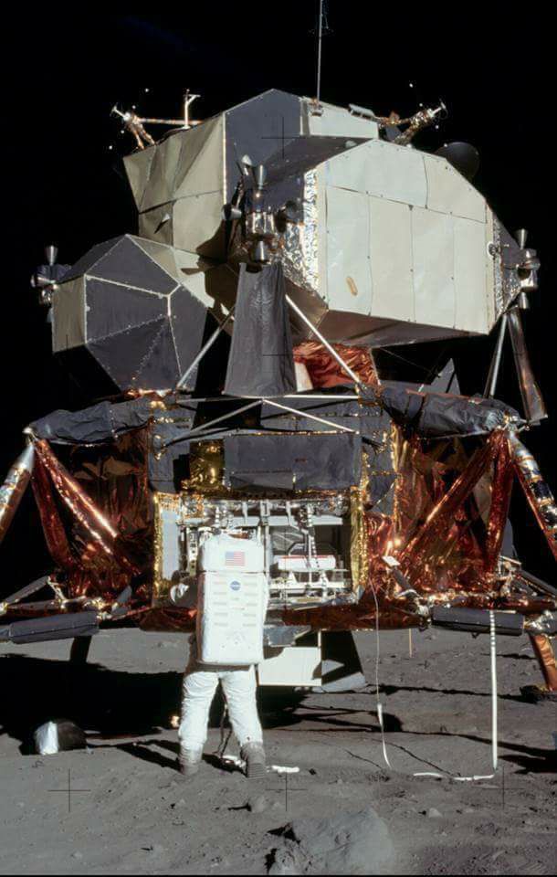
Do you really believe this jalopy traveled through space?

Where is the blast crater this pile of junk would have made?


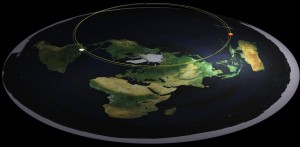
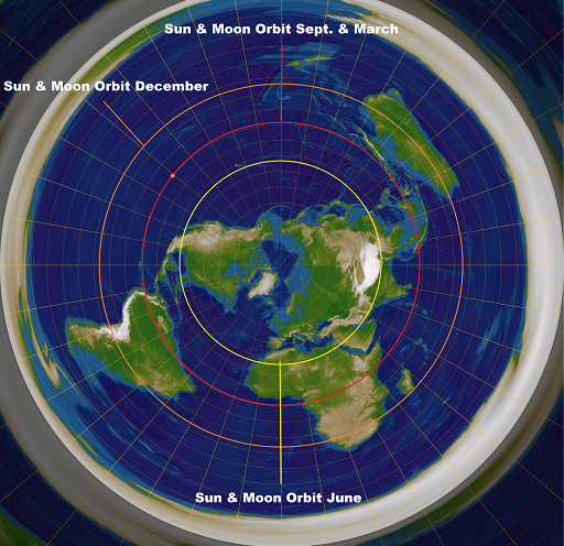
The earth is flat and evolution is a lie from the pit of hell. The moon and the sun are roughly the same size, are at the same distance from and revolve around the earth JUST LIKE THE BIBLE SAYS.

Flat_earthqq

The Bible clearly refers to the earth being a circle not a sphere and of course having a solid structure above it supporting waters ABOVE IT. Genesis 1:6 refers to the firmament. Even the pastors are in on this scam. Look the Bible is clear and the Hebrew is succinctly clear: The word RAQIA IS THE EXACT WORD IN GENESIS 1 verse 6. YOU ARE BEING LIED TO BY EVERYONE INVOLVED INCLUDING YOUR PASTOR.

רָקִיעַ noun masculineGenesis 1:6 extended surface, (solid)

2 the vault of heaven, or ‘firmament,’ regarded by Hebrews as solid, and supporting ‘waters’ above it, Genesis 1:6,7 (3 t. in verse);Genesis 1:8 (called שָׁמַיַם; all P), Psalm 19:2 (“” הַשָּׁמַיַם), ׳זֹהַר הָרDaniel 12:3; also ׳ר הַשָּׁמִיִם Genesis 1:14,15,17, ׳הַשּׁ ׳עַלמְּֿנֵי רGenesis 1:20 (all P). **רְקִיעַ עֻזּוֺ Psalm 150:1 (suffix reference to ׳י).

This is a Scriptural fact on cosmology. It represents a firm and impassable barrier between the world of man (below) and the abode of God (above).

“Praise him, ye heavens of heavens, and ye waters that [be] above the heavens.”
(Psalms 148:4 KJV)

The Hebrew word that is used in Isaiah 44:22 (חוּג, chug) does not at all imply a spherical earth. The root word only occurs in the Hebrew Bible once as a verb (Job 26:10). In nominal forms, the same root occurs four times, three as the noun חוּג (chug; Job 22:14, Prov 8:27, Isa 40:22), and once as the noun מְחוּגׇה(mechugah; Isa 44:13). This term refers to a “circle instrument,” a device used to make a circle, what we call a compass.

I DIDN’T WRITE THE BIBLE SO DON’T ARGUE WITH ME. It says what it says and there is a reason the sky is blue and the Milky Way looks like a tear in the dome because that is where the flood came from when the HEAVENS WERE OPENED FOR THE GREAT FLOOD OF NOAH. THE WATERS WERE AND ARE STILL ABOVE THE DOME. THE MILKY WAY THAT YOU CAN SEE WITH YOUR OWN EYES CLEARLY SHOWS WHAT WAS ONCE A TEAR IN THE DOME.
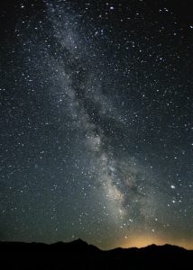

Milky_Way_Night_Sky_Black_Rock_Desert_Nevada

IQJCv

THESE ARE REAL PHOTOS OF WHERE THE TEAR WAS IN THE DOME. ANY OTHER IMAGES SHOWING SPIRALS ETC ARE NASA FAKES. ALL WE CAN SEE IS WHAT IS REAL-THE OPENING WHERE THE FLOOD WATERS ABOVE CAME DOWN DURING THE GREAT FLOOD.

You wonder why a 4,700 man military operation “operation high jump” was run to investigate the ice ring that surrounds the entire earth, then “operation fishbowl” was run to electrify and electrically charge the dome by detonating nuclear bombs hundreds of miles up in the atmosphere. This was necessary to perfect the microwave communications that are accomplished by bouncing a signal off of the dome.


https://www.youtube.com/watch?v=2Gmqdqvp00w

Once they were successful, the atmospheric test ban was signed, the Antarctic treaty was signed keeping it off limits, then NASA was formed to monopolize  and fake space images and control exploration as space was militarized making it off limits, and then the fake space program served up to keep our eyes on their lies like the totally faked moon landings. How many astronauts were murdered to keep the lid on this fraud.  FULLERTON HAS AN ASTRONAUT PARK NAMED AFTER EACH ONE OF THEM.

NASA is a Military-Hollywood-Pseudoscience-Satanic Cartel, whose true purpose is to deceive and fleece the masses. Through, in some cases elaborate, trick photography and in most cases not, with the help of the media mind control master and the educational system, they inculcate an atheistic world view with all of the rote repetition of a spinning ball earth in a heliocentric universe that is the diametric opposite of the Biblical truth of the world we actually live in. NASA EXISTS TO SUBTLY GET HUMANITY TO REMOVE GOD OUT OF EVERYTHING BY RUNNING COMPLETE INTERFERENCE WITH PURE SATANIC AND OCCULT DECEPTION RIGHT IN YOUR FACES and of course to siphon trillions dollars into black budget secret programs such as advanced technologies, weaponries and massive underground facilities.
203f5f6f0f3697feade72debd6737a28

download-4


Question: Why do those living in the Southern Hemisphere see the moon upside down in relation to those living in the Northern Hemisphere?  Does this not prove that the Earth is round?

Answer: The difference in the way that the moon appears to those in the north versus those in the south is simply due to perspective, not the Earth’s rotundity.  Because the moon’s path generally follows the equator (staying between the Tropic of Cancer and the Tropic of Capricorn), those south of the equator view it from a different angle than those north of the equator.  It is drastically oversimplified to say that that those in the south see the moon “upside down” in relation to those in the north.  In reality, the moon’s perceived orientation will be slightly different from every viewing angle.

The significance of viewing perspective can easily be demonstrated by the following:

  1. Walk to one side of the room.
  2. Look up at the light on your ceiling.  (Imagine this light is the moon.)
  3. Now, move to the opposite side of the room.  (When you do this, imagine you are crossing the equator, and moving into the other “hemisphere.”
  4. When you turn around and look up at the light [moon] now, it will appear upside down from your original perspective.  The side that was originally opposite your view is now closest to you.

Flat Earth - Moon Orientation

It is drastically oversimplified to say that that those in the south see the moon “upside down” in relation to those in the north.  In reality, the moon’s perceived orientation will be slightly different from every viewing angle.  In the above image, those in the north will see “A” more as the top and “B” more as the bottom.  Those in the south will see “B” more as the top and “A” more as the bottom.  (Bear in mind that the moon is being viewed from beneath.  Perspective makes it appear that the closest side is the “top.”)


NASA engages in total fraud and while they use taxpayer funding to promote  and profit by developing and deploying pseudoscience technology and methodology leading the gullible masses to hide, confuse, refute or discount the God of the Bible, His Truth and His creation. That is their real mission. Like their boss, lucifer, they are liars, thieves and murderers. This is what we live on and this is how this Divine time piece works.

Sun-MoonSmall

maxresdefault

YES AND THIS IS ALL WHILE SCHOOLS TEACH YOUR CHILDREN TO BE IDIOTS WITH LIE AFTER LIE AS THEY FORCE YOUR CHILDREN TO BE INJECTED WITH STERILIZING TOXIC METALLIC NANO TECH VACCINES, FORCE THEM TO BE STERILIZED BY WIRELESS MICROWAVE CLASSROOM EMISSIONS, TO BELIEVE THERE IS NO GOD, AND HOW TO BE THE ULTIMATE FORM OF CHATTEL PROPERTY ALL THE WHILE THEY TURN THEM INTO SELFISH, SEX CRAZED, MATERIALISTIC, STATIST, SATANICALLY MIND CONTROLLED MEDIA SLAVES THAT NOW COMPRISE THE BIGGEST FLOCK OF SHEEP HEADED FOR SLAUGHTER IN HUMAN HISTORY.

unnamed-1-297x300 (1)

Water is always level. Plumb is perpendicular to the level so the earth cannot be a sphere. Using the angles from shadows from goal posts and standard grade trigonometry you can show sun is close by in the sky above. The world is flat and motionless. The biggest proof of spherical earth was NASA. Hindenburg was another hoax to stop people using balloons which are cheap! We live in the Trueman show in arrested development. Aeronautics is stagnant and has been for years. The world is run by actors. Our reality is not holographic but is illusory nonetheless. Our perceptions are managed from childhood. History is fabricated.

NASA’s dead astronauts that are still alive and well from the Sandy Hook of the 80’s

NASA challenger crew still alive and well

dead_1986

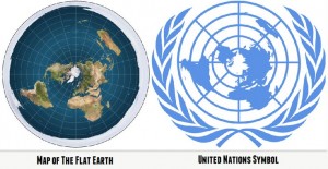
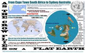
 Yes gravity can hold the oceans on a supposed ball spinning 1000 miles an hour yet it can’t hold a mosquito on the ground. Thousands of supposed satellites and not one real image of the earth from space, just artist renderings and CGI’s. 7th grade trig puts the sun at 3100 miles away with a white moon getting its light from an orange sun. Tides affect the oceans yet not the great lakes. The flight paths are a total joke until you plot them on the flat earth map that the UN uses for its flag and all of a sudden they become straight lines. Well if that isnt enough to stretch your imagination, NASA keeps insulting your intelligence with more lies.

JUST LOOK AT THIS RECENT NASA PHOTO AND THE EARTH’S SIZE SUPPOSEDLY TAKEN FROM A MILLION MILES AWAY in mid July 2015 WITH THE MOST MODERN ADVANCED EQUIPMENT AVAILABLE. IT SHOWS A MASSIVE EARTH AND A SMALL MOON FROM A MILLION MILES AWAY ? DONT TRUST ME, LOOK THESE UP FOR YOURSELF-

download (33)

NASA IMAGE FROM JULY 2015 SUPPOSEDLY 1 MILLION MILES FROM EARTH

OPEN YOUR EYES AND ASK YOURSELF WHAT KIND OF TRILLION DOLLAR TREASON IS THIS?

apollo11return_nasa

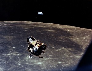
FOOTAGE FROM APOLLO 11 1969

NOW COMPARE IT TO THE ONE FROM 40+ YEARS AGO SUPPOSEDLY TAKEN FROM THE MOON-THE EARTH SHOULD APPEAR TO BE MASSIVE! THIS IS A TOTAL JOKE LADIES AND GENTLEMEN. HOW CAN NASA BE SO STUPID? DO THEY FORGET WHAT THEY LIED ABOUT 40 YEARS AGO? OR IS IT BECAUSE THEY KNOW THAT ALL OF YOU HAVE BECOME SO STUPID AND WOULD NEVER QUESTION ANY OF THIS. 

HATE ME, GET PISSED AT ME I DONT CARE-JUST ASK YOUR FIVE YEAR OLD THIS QUESTION.  DOES AN OBJECT APPEAR TO GET SMALLER AS IT GETS FARTHER AWAY?

HOW CAN THE EARTH, WHEN LOOKED AT FROM THE MOON, APPEAR TO BE SMALL, YET WHEN THE EARTH IS LOOKED AT FROM BEHIND THE MOON EVEN FURTHER AWAY, THE EARTH APPEARS TO BE MASSIVE?  IT DEFIES LOGIC.

-THESE PHOTOS ALONG WITH THE REST OF NASA’S COMPUTER GENERATED IMAGES ARE ALL FAKE-PERIOD.

IF YOU WERE ON THE MOON, EVEN CLOSER TO THE EARTH, THE EARTH WOULD APPEAR EVEN BIGGER THAN THIS NASA FAKE FROM THE FAKED MOON LANDING-JUST LOOK AT THE PHOTO BELOW THIS ONE AGAIN

AS11-44-6551

WHAT KIND OF PERSPECTIVE IS THIS?

images

NASA 2015

IT IS THE PERSPECTIVE OF BEING UNABLE TO THINK. LOOK AT THE TINY EARTH FROM THE FAKE PICTURES SUPPOSEDLY TAKEN FROM THE MOON 40 YEARS AGO-

apollo11return_nasa

NASA 1969

NASA is nothing more than a masonic, occult and deeply satanic deception operation. It was founded by Satanic worshiping occultists and black magicians.

NASA is a Military-Hollywood-Pseudoscience-Satanic Cartel, whose true purpose is to deceive and fleece the masses. Through, in some cases elaborate, trick photography and in most cases not, and mind control hoaxes, they inculcate an atheistic world view with all of the rote repetition of a spinning ball earth in a heliocentric universe that is the diametric opposite of the Biblical truth of the world we actually live in. They engage in total fraud and while they use taxpayer funding to promote and profit by developing and deploying pseudoscience technology and methodology leading the gullible masses to discount the real God of the Bible and His creation. That is their real mission. Like their boss, lucifer, they are liars thieves and murderers. Misery loves company.

THE MOON LANDINGS WERE A TOTAL FAKE BORDERING ON A TOTAL JOKE-

https://thefullertoninformer.com/a-paper-moon/


https://youtu.be/4WPBDte2AfY

VIRGIL “GUS” GRISSOM WAS JUST ONE OF MANY KILLED TO KEEP THIS LIE GOING. WE HAVE BEEN LIED TO ABOUT EVERYTHING LADIES AND GENTLEMEN. IF THEY WILL LIE ABOUT THIS, THERE IS NO END TO THE DECEPTION AND THE DEPTHS WE WILL BE TAKEN DOWN TO. THIS HAS BEEN GOING ON FOR A LONG TIME.

https://youtu.be/V0MWPJqVoUc

Instinct is something which transcends knowledge. We have, undoubtedly, certain finer fibers that enable us to perceive truths when logical deduction, or any other willful effort of the brain, is futile.” –NIKOLA TESLA

https://youtu.be/-FIDaDh4SpQ

HAVE THE EDUCRAT LACKEYS FINISHED OFF YOUR CHILDREN’S ABILITY TO THINK WITH MIND BENDING ROTE REPETITION OF USELESS CRAP THAT THEY CALL AN EDUCATION JUST SO THEY CAN GET A JOB DEVELOPING WEAPONIZED TECHNOLOGY  OR POISONOUS MEDICATIONS TO SOFT KILL THE UNSUSPECTING ?

https://youtu.be/cXYQilNcjRY

HAVE THE EDUCRAT LACKEYS WITH THEIR RIDICULOUS BS SCIENCE FINISHED OFF YOUR CHILDREN’S INNATE INSTINCTS THAT GOD CREATED THEM AS WELL AS EVERYTHING IN THE WORLD? HAVE THE EDUCRAT LACKEYS FINISHED OF YOUR CHILDREN’S CONNECTION TO THE ONE WHO PUT THE 75,000 MILES OF CIRCULATORY SYSTEM IN THE INCREDIBLE BODIES?

https://youtu.be/y03bfOps34I

THEY ARE LYING TO US ABOUT EVERYTHING FOLKS AS THEY FORCIBLY INJECT YOUR CHILDREN, POISON THE WATER AND FOOD, SPRAY THE SKIES WITH LINE AFTER LINE OF AEROSOLIZED CHEMTRAILS, AND DROWN YOU ALL IN A COCKTAIL OF BOOZE, PILLS, PORN, LACED FAKE FOODS, ASPARTAME LACED BEVERAGES AND ENDLESS STERILIZING ZOMBIFYING WIRELESS EMISSIONS.

THIS IS ALL A SATANIC DECEPTION TO GET GOD OUT OF THE PICTURE SO THEY CAN TELL YOU ALL THAT YOU ARE NOTHING MORE THAN A BUNCH OF ACCIDENTS AND ANIMALS SO THEY CAN TURN AROUND AND TURN YOU ALL INTO A BUNCH OF ANIMALS, TREAT YOU LIKE A BUNCH OF ANIMALS, AND CAREFULLY ENGINEER YOUR DEMISE TO APPEAR TO BE AN ACCIDENT-IT IS ALREADY HAPPENING. LOOK AROUND!

OPEN YOUR EYES BEFORE THE SCREEN TIME INDUCED MACULAR DEGENERATION MAKES IT NO LONGER POSSIBLE TO PERCEIVE REALITY THE WAY A FIVE YEAR OLD DOES WITH THE GOD GIVEN GIFT OF HIS TWO EYEBALLS HALF CLOSED.

http://www.zengardner.com/occult-roots-nasa-ongoing-fraud/

The Bible is either wrong or NASA is wrong. Either The Bible is a lie or NASA is a lie. The Bible clearly states the earth is flat covered by a dome. NASA claims the earth is round and revolves around the sun.  From ancient civilizations to modern times we are told that the earth is flat with a dome Hebrew, Ancient Egyptian, Babylonians, Chinese, Indians, Greeks, Poets, Philosophers, Historians and modern evidences tell us that the earth is flat. So why does everyone believe what NASA tells us? Which one is it? You decide whether or not The heavens declare the glory of God; and the firmament sheweth His handywork..

milkyway_2629161b

The government has had a monopoly over the media, press and academia for decades.

Couple that with the 13 years of compulsory education mandated to indoctrinate every man woman and child in the US and you have little room for debate or do we? The Universities and the academic intellencia take it up on a logarithmic scale and yet the only photos of the earth from so called space or satellites are ALL ARTIST RENDERINGS OR COMPUTER GENERATED IMAGES. Your eyes and your basic instincts tell us the sun and the moon are the same size, located very close to us as the naked eye cannot see a moon  crater 40 miles across 238,000 miles away, that the oceans cannot stay on a 1000 mile per hour spinning ball and that the 75,000 miles of circulatory system did not get into our bodies by accident. Yet we submit our bodies and minds to those who deny that The heavens declare the glory of God; and the firmament sheweth His handywork.

It is the school district personnel who teach just that. These are the ones who cement the lies after, through endless rote repetition, they ram the fables deep into the impressionable minds of the children. Do they know what they are part of? How can it be that reasonable, logical people that supposedly are the critical thinkers take part in such a vile endeavor, that is the teaching of the lie of evolution? What are these people thinking? They are not. They are walking lockstep with the machine that turns out children who do not know or believe in God and who can no longer think and interpret what is right in front of their eyes even though The heavens declare the glory of God; and the firmament sheweth His handywork.

The school district personnel are all in on it, every last one of them. Where are all the so called  moral giants, or the so called christian teachers and staff? Why are they silent? Where is their fiece vocal opposition to these flat out lies? Yes they are all part of a regressive, massive dehumanization and sterilization agenda, drugging the children with vision destroying technology,

WHAT ARE THEY DOING TO YOUR CHILDREN?

We know that the technology push in schools is being called a 60 billion dollar hoax. It is actually a 60 billion dollar success because what Time magazine wont tell you is that the 60 billion dollar educational hoax is truly a hoax, The fact is that it is a 60 billion dollar deployment of a weaponized microwave system designed to sterilize your children. Yes they are all part of a regressive, massive, reproductive organ destroying wireless classroom technology forced irradiation program that is turning them into satanic video game addicts, teaching them the lies of evolution, the lie that there is no God, that wireless is harmless and that vaccines are safe and not part of a eugenics agenda. Does it logically follow that the school district personnel are not the most dangerous and evil people alive right now because of what they are doing to all the children? Yes you heard me the same ones doing this are the ones who hide that The heavens declare the glory of God; and the firmament sheweth His handywork..

Apple 666, Artemis, iPads (infertility pads), Project Inkwell, Connect ED, E-rate, and Agenda 21-an expose with an all star cast –

They sit back and remain silent on the brain damaging sterilization by the forced microwave exposure in the classrooms, refusing to warn parents, accept information and warn the students. They are silent on the perversion being foisted on our children, they are silent on the forced vaccinations that are now part of school entry requirements. They are silent on the lies of evolution, silent on the dehumanization of children they are taking part in and silent on everything that matters except when it comes to their paltry paychecks. Go look out in front of the high schools in Fullerton right now and you will see these overpaid lackeys pissed off about the fact the $125,000 a year is not enough for 6 1/2 hour workdays for less than half the year as they lock the children out of class for tutoring and college letter of recommendation writing.

https://thefullertoninformer.com/troy-high-school-teachers-abruptly-close-door-to-students/

Yes of course That is when they speak up while they all ignore that The heavens declare the glory of God; and the firmament sheweth His handywork.

Firmament does not refer to empty air, a blue sky or a level of the atmosphere, it refers to a physical structure. It refers to the dome that covers the earth, and stated as such in some Bible translations. Yes it is the dome that no rocket ship or 33rd degree mason phony astronaut con job clown has ever passed through with a fake spaceship that really just crashed down in the ocean right after it launched.

The firmament sheweth His handy work. Why hide the dome from us? Why discredit the first chapter of The Bible? Because the total bull crap of evolution folds like a bad hand when people that have been so dumbed down to believe it in the first place realize that a dome over us means that someone put it there and put us under it. Thank the school district personell for all this moral relativism, political correctness, joke science and of course the 65 shots in your children’s bloodstreams and the wireless device in their laps. How long are all you parents and school district sycophants and lackeys going to go along with all of this or are you too going to ignore that The heavens declare the glory of God; and the firmament sheweth His handywork.

And yes, there are the doctors, with their academic arrogance, who think the man in the sky is some sort of a joke. In Fullerton look no further than the most outspoken enemies of God in town who mock God, and whose wife publicly calls for ending prayer at public meetings while they both push for the forced irradiation of school children all over California. Just look how and where all that education got those two who publicly ignore and protest that The heavens declare the glory of God; and the firmament sheweth His handywork.

I guess the the toxic drugs, toxic treatments and eugenicist shots, are right there behind all of them to help guide the way. Look what these closed minded automaton school district and medical establishment thugs have done to you, your friends, your parents and are now doing to an entire generation of children as these get their body, soul, health and spirit sucked to hell by the well coordinated orchestration of all of the aforementioned on their watch with their blessing.

It were better for him that a millstone were hanged about his neck, and he cast into the sea, than that he should offend one of these little ones. -The words of Jesus Christ.

Actually It applies to all of them, especially to the nurses and social workers that are putting all these children on medication when what they really need is the knowledge that God made them and God loves them. No such luck at school where they are taught starting in kindergarten that they can have two dads, two moms, that they came from animals, rocks, monkeys and muck and became what they are as a result of some cosmic accident with their faces glued to screens all day and night while they ignore, forget or simply cannot fathom that The heavens declare the glory of God; and the firmament sheweth His handywork.

I challenge all of you to consider what has been the norm in our brainwashed society and open your eyes to the ancient wisdom so timelessly established in God’s word that to this very day, remains under attack from some of the most evil people in all of human history who subvert the fact that The heavens declare the glory of God; and the firmament sheweth His handywork.

How can a student of the Bible, or even a seminary graduate, believe and even instruct the flock that science has proven The Bible to be in error? How do you ignore chapter 1 when your entire business model is built around the contents of this book? Yes even the dumbed down phony pastors and the pickpocket preachers in the phony churches that go along with all of this for a few measly bucks just so they can sleep in everyday and ignore that The heavens declare the glory of God; and the firmament sheweth His handywork.

You will never hear a sermon on Genesis 1 that tells the truth about what we actually live on or one that exposes:

NASA’S TRILLION DOLLAR TREASON

If they can con everyone into believing that there is no God, that we all came from rocks, that we are all animals, that there is no purpose to any of this, then I can assure you ladies and gentlemen, they will treat us like rocks and animals. Sadly with the forced vaccinations, the satanic media, the disgusting fake toxic food, the booze, pills, dope, porn, the wireless emissions beaming through our walls, forced into the laps of children at school, the dosed water, the sprayed skies and the outright lies of the educational and medical system that ARE IN DIAMETRIC OPPOSITION to the Word of God, we are already in dire straights in need of a massive and abrupt about face. The second biggest lie ever told is right here before your eyes. Please open them before you end up spending eternity in darkness. The Bible is true, the earth is flat and anyone who tells you otherwise is simply a victim of an educational system that is designed to promulgate regression disguised as intellectual prowess flanked by foolishness that remains bound up in the child that they can never admit they still are. Take 25 minutes and judge for yourself. The lies have it ladies and gentlemen, and they also have your children all by the throat. It is time to break the grip. The day has finally arrived. The choice is yours.

https://youtu.be/bdxgIyEPCxk

  1. #1 by Anonymous on June 27, 2016 - 6:43 am

    “Conclusion

    If the Earth is flat, as the vast amount of evidence seems to show, then the flat Earth conspiracy amounts to the biggest cover-up and lie ever perpetrated against humanity; a lie that has literally lasted for hundreds of years and must necessarily permeate many institutions. If true, the implications of how much brainwashing and control we’re under is absolutely frightening and you’ll begin to see it everywhere. But is there any other “fact” that we were programmed to believe more than the shape of the Earth? The globe model was pushed on us from the earliest age, why?

    For me (others may disagree), the strongest pieces of evidence in support of the flat Earth are the following:

    No Curvature. No measurable curvature even though the curvature should be EASILY detectable with modern instruments and experienced in everyday life.

    No Photographs of the Earth from Space. Despite the claim that there are thousands of satellites far away enough from the Earth to take a picture of the whole Earth, there are admittedly no legitimate photographs of the Earth; NASA even says that these photographs were created to “match people’s expectations.” Is that science or propaganda? Other evident fakery from space agencies, including the ISS and the Space Shuttle, further supports this argument.

    The Sun and Moon are Local. The Sun is not 93 million miles away (and the Moon is not 234,000 miles away) as proven from various time-lapse videos, decreasing/increasing sizes, light concentration, hot spots, trigonometry, and other means.

    The Professionals. Pilots, engineers, surveyors, gunners, artillerymen, radar operators, etc. do not account for curvature in any manner.

    The Non-Spinning Atmosphere. The atmosphere evinces no properties of spin as required by fluid dynamics. The purported 1,000 mph spin of the Earth at the equator should have a tremendous impact on flights, water, volcanic eruption plumes, skydivers, weather balloons, wind, etc., but there’s no evidence of such a spin. The Coriolis Effect’s impact on the directional rotation of storms at the hemisphere only supports the flat Earth and has no further application despite widespread lies about snipers and Foucault Pendulums.

    No Centrifugal or Other Forces of Movement Detected. Even though centrifugal forces may increase substantially from the arctic to the equator (from 100 mph to more than 1,000 mph), weight does not change (an estimated 0.3% change in weight should be measurable with modern equipment and affect manufactures and there is no change in weight whatsoever). Further, a point on the Earth is sometimes supposedly moving with the 66,600 mph orbit and sometimes against it; these possibly radical centrifugal force changes have no physical effect on an individual and are not measurable. Moreover, the Earth supposedly orbits the Sun at 66,600 mph as the Earth spins at 1,000 mph. On one side of the Earth, the ground would be moving 66,600 mph towards your feet; on the other side of the Earth, the ground below you would be moving away from your feet at 66,600 mph. This daily and drastic change should be felt or measured daily and gravity does not seem to account for it. Moreover, engineering manuals show that the outer rim of the Earth could not support a spin of 1,000 mph and would disintegrate.

    The Explanation of Daylight and Stars is Not Workable on the Globe Model. Based on the “official” globe model where daylight should be located between the Earth and the Sun, there should be a substantial global change of stars every six months as the nights should be pointed in opposite directions when the Earth is on opposite sides of the Sun. Because this doesn’t happen, the globe model must be false.

    Same-Sized Sun and Moon. Despite the purported extreme differences in distance and size, the Sun and Moon are almost the same size from our perspective – a statistical impossibility by chance alone. Also, the Sun and Moon both spin facially the same distance throughout the same time period (a fact ignored by science) – how’s that possible under the globe model?

    Properties of Water. The level properties of water and no bulging of the oceans at the equator despite the spin demonstrate that Earth is not a spinning a ball.

    The Impossible Moon. In the video of an amateur rocket launch, the Moon appears very small but well above the horizon when it should be on the other side of the Earth proving that the Moon and Sun circle above a flat surface.

    The Vacuum of Space. There’s no way that our atmosphere supposedly parallels an enormous vacuum. The vacuum of space would overpower any hold that gravity would have over the low-mass atmosphere. Our atmosphere should burst out into space as the top of the “space ship” is wide-open.
    The North Star. The “official” globe model says that the Earth is currently spinning at 1,042 mph, wobbling, bouncing daily, and revolving around the Sun at 66,600 mph; the Sun (taking the Earth with it) is moving at 447,000 mph; the whole galaxy is moving at 373 miles/second; and, the entire universe continues to expand from the Big Bang. Meaning that the Earth is moving in various direction at more than 1,860,000 mph. The problem? The North Star has NEVER changed its position in known history and that certainly belies common sense.

    The Non-Wobbling Sun in the Arctic. During the 24-hour days of daylight, videos show the Sun spin in a circle over the Arctic sky horizon. However, the Sun should not spin but follow a zig-zag pattern if the “official” model was correct. This proves the “official” model is false and the evidence fits perfectly on a flat Earth model.

    The Ridiculous Spinning-Vortex Model. “Official” science says that the entire solar system is chasing after the Sun that is moving at approximately 2 million mph. That means all planets, comets (even those moving in and out of the solar system), repeating meteor showers, moons, artificial satellites, etc. are all chasing after the Sun, which is at a incomprehensible distance away from objects such as Pluto and comets, but all planets somehow maintain the same horizontal plane despite the lessening effects of gravity at much further distances, and still all objects maintain tabular repeating performance year after year for thousands of years chasing after a Sun that should be leading the way. No one ever shows how this entire model works at scale because it’s asinine.
    Why the deception?

    This is only speculation but I think there may be a few reasons:

    To hide land and resources; to keep the human cattle within their imaginary fences (like The Truman Show).
    To hide God.
    To control our minds; a psychological matrix, i.e., to make us believe that 2+2=5. If our evil overlords can convince us to ignore our own experience and blindly trust the illogical “official” story, then we can be controlled to do and accept anything.
    Interestingly, the alleged spherical shape of the Earth was very important to Luciferians, Atheists, and possibly Freemasonry as it removed the idea of above (heaven) and below (hell). Here’s a quote from the publication Lucifer from December 23, 1887:

    “We date from the First of January, 1601. This era is called the Era of Man (E.M.) to distinguish it from the theological epoch that preceded it. In that epoch the Earth was supposed to be flat, the Sun was its attendant light, revolving about it. Above was Heaven, where God ruled supreme over all potentates and powers; below was the kingdom of the dead, hell. So taught the Bible. Then came the new Astronomy. It demonstrated that the Earth is a globe revolving about the sun, that there is no ‘up and down’ in space. Vanished the old Heaven, vanished the old Hell; the Earth became the home of man. And when the modern Cosmogony came, the Bible and the Church, as infallible oracles, had to go, for they had taught that regarding the universe which was shown to be untrue in every particular.”

    – Lucifer, Dec. 23rd, E.M. 287 (1887). See also: https://www.kshs.org/p/kansas-historical-quarterly-front-page-from-lucifer-the-light-bearer/13208

    Note that on the globe there is no “up and down,” meaning there is no heaven and no hell – there is only man. That also has significance for Satanism and Freemasonry – “As above so below.” “In Magick (Book 4), Crowley asserted that Baphomet was a divine androgyne and ‘the hieroglyph of arcane perfection’: Seen as that which reflects. ‘What occurs above so reflects below, or As above so below.’” https://en.wikipedia.org/wiki/Baphomet.

    In addition to eliminating God, the spherical shape acts like a mental control to the development of the human mind. In the book 1984, George Orwell presciently wrote the following (pertinent excerpt below: http://www.thirdworldtraveler.com/Authors/Part_Three_1984.html):

    O’Brien silenced him by a movement of the hand. “We control matter because we control the mind. Reality is inside the skull. You will learn-by degrees, Winston. There is nothing that we could not do. Invisibility, levitation-anything. I could float off this floor like a soap bubble if I wished to. I do not wish to, because the Party does not wish it. You must get rid of those nineteenth century ideas about the laws of nature. We make the laws of nature.”. . . .

    “But the whole universe is outside us. Look at the stars! Some of them are a million light-years away. They are out of our reach forever.”

    “What are the stars?” said O’Brien indifferently. “They are bits of fire a few kilometers away. We could reach them if we wanted to. Or we could blot them out. The earth is the center of the universe. The sun and the stars go round it.”. . . . When we navigate the ocean, or when we predict an eclipse, we often find it convenient to assume that the earth goes round the sun and that the stars are millions upon millions of kilometers away. But what of it? Do you suppose it is beyond us to produce a dual system of astronomy? The stars can be near or distant, according as we need them. Do you suppose our mathematicians are unequal to that? Have you forgotten doublethink?”

    What follows is another fascinating quote from Orwell who said that the evidence in support of the globe theory is “precarious” and seemingly built on nothing more than an appeal to authority. Also, Orwell pointed out that the vast majority of people get “angry” when confronted with alternative theories because of society’s credulity and sad acceptance of authority.

    http://alexpeak.com/twr/hdykteir/

    SOMEWHERE or other—I think it is in the preface to Saint Joan—Bernard Shaw remarks that we are more gullible and superstitious today than we were in the Middle Ages, and as an example of modern credulity he cites the widespread belief that the earth is round. The average man, says Shaw, can advance not a single reason for thinking that the earth is round. He merely swallows this theory because there is something about it that appeals to the twentieth-century mentality.

    Now, Shaw is exaggerating, but there is something in what he says, and the question is worth following up, for the sake of the light it throws on modern knowledge. Just why do we believe that the earth is round? I am not speaking of the few thousand astronomers, geographers and so forth who could give ocular proof, or have a theoretical knowledge of the proof, but of the ordinary newspaper-reading citizen, such as you or me.

    As for the Flat Earth theory, I believe I could refute it. If you stand by the seashore on a clear day, you can see the masts and funnels of invisible ships passing along the horizons. This phenomenon can only be explained by assuming that the earth’s surface is curved. But it does not follow that the earth is spherical. Imagine another theory called the Oval Earth theory, which claims that the earth is shaped like an egg. What can I say against it?

    Against the Oval Earth man, the first card I can play is the analogy of the sun and moon. The Oval Earth man promptly answers that I don’t know, by my own observation, that those bodies are spherical. I only know that they are round, and they may perfectly well be flat discs. I have no answer to that one. Besides, he goes on, what reason have I for thinking that the earth must be the same shape as the sun and moon? I can’t answer that one either.

    My second card is the earth’s shadow: when cast on the moon during eclipses, it appears to be the shadow of a round object. But how do I know, demands the Oval Earth man, that eclipses of the moon are caused by the shadow of the earth? The answer is that I don’t know, but have taken this piece of information blindly from newspaper articles and science booklets.

    Defeated in the minor exchanges, I now play my queen of trumps: the opinion of the experts. The Astronomer Royal, who ought to know, tells me that the earth is round. The Oval Earth man covers the queen with his king. Have I tested the Astronomer Royal’s statement, and would I even know a way of testing it? Here I bring out my ace. Yes, I do know one test. The astronomers can foretell eclipses, and this suggests that their opinions about the solar system are pretty sound. I am therefore justified in accepting their say-so about the shape of the earth.

    If the Oval Earth man answers—what I believe is true—that the ancient Egyptians, who thought the sun goes round the earth, could also predict eclipses, then bang goes my ace. I have only one card left: navigation. People can sail ships round the world, and reach the places they aim at, by calculations which assume that the earth is spherical. I believe that finishes the Oval Earth man, though even then he may possibly have some kind of counter.

    It will be seen that my reasons for thinking that the earth is round are rather precarious ones. Yet this is an exceptionally elementary piece of information. On most other questions I should have to fall back on the expert much earlier, and would be less able to test his pronouncements. And much the greater part of our knowledge is at this level. It does not rest on reasoning or on experiment, but on authority. And how can it be otherwise, when the range of knowledge is so vast that the expert himself is an ignoramous as soon as he strays away from his own speciality? Most people, if asked to prove that the earth is round, would not even bother to produce the rather weak arguments I have outlined above. They would start off by saying that ‘everyone knows’ the earth to be round, and if pressed further, would become angry. In a way Shaw is right. This is a credulous age, and the burden of knowledge which we now have to carry is partly responsible.”

    jwlpeace | June 26, 2016 at 4:32 am | Categories: Uncategorized | URL: http://wp.me/p5NdDV-RB

    https://aplanetruth.info/2016/06/26/fe-overview-50-points/

    • #2 by Joe Imbriano on June 28, 2016 - 6:23 am

      If the earth was not flat, this would never function. Break your conditioning folks. This would have never been patented if it was not how it is.

      http://www.google.com/patents/US3858334

      Universal planisphere complete guidance and computer system
      US 3858334 A
      ABSTRACT
      A planisphere for providing displays and effecting calculations in both astronomy and navigation and the method of operation thereof. The planisphere structure includes plurality of substantially circular, concentric, flat dials which are progressively larger in diameter toward a central, largest diameter dial on both sides of the central, largest diameter dial. The dials are pivotally mounted centrally and have both astronomy and navigation oriented scales as well as star and polar azimuthal equidistant projection maps thereon. Reference rules and transit scale indicators, Greenwich indicators and Aries indicators, the latter three of which are part of specific planisphere dials, extend radially outwardly of the largest diameter dial on both sides of the planisphere and are connected together radially outwardly of each other respectively so that they may be readily moved relative to each other in angularly positioning the dials in operation of the planisphere. An altitude and azimuth circle reference indicator is provided with the planisphere to aid in triangulation operations and determining relative altitude and azimuth of celestial bodies when it is located on the assumed coordinate position of the navigator.
      IMAGES(7)
      Patent Drawing

      Patent Drawing

      Patent Drawing

      Patent Drawing

      Patent Drawing

      Patent Drawing

      Patent Drawing

      CLAIMS available in
      DESCRIPTION (OCR text may contain errors)
      Unite i1 Eisenhauer States Patent Jan. 7, 1975 UNIVERSAL PLANISPIIERE COMPLETE GUIDANCE AND COMPUTER SYSTEM [75] Inventor: William A. Eisenhauer, Van Wert,

      Ohio

      [73] Assignee: The Eisenhauer Manufacturing 1 Company, Van Wert, Ohio [22] Filed: July 3, 1972 [21] App]. No.: 268,646

      Related US. Application Data [63] Continuation-impart of Ser. No. 500, Jan. 5, 1970, Pat. No. 3,678,710, which is .a continuation of Ser. No. 600,920, Dec. 12, 1966, abandoned, which is a continuation-in-part of Ser. No. 369,958, May 25, 1964, Pat. No. 3,290,799, which is a continuation-in-part of Ser. No. 271,658, April 9, 1963, Pat. No. 3,251,143, which is a continuationimpart of Ser. No. 851,648, Nov. 9, 1959, Pat. No. 3,088,228.

      [52] US. Cl. 35/44 [51] Int. Cl. G09b 29/00 [58] Field of Search 35/44, 43; 58/3, 42.5, 58/43 [56] References Cited UNITED STATES PATENTS 497,917 5/1893 Gleason 35/44 531,060 12/1894 Ormsby 35/44 1,873,595 8/1932 Johnson 35/44 2,921,386 1/1960 Stefano 35/44 3,290,799 12/1966 Eisenhauer…. 35/44 3,673,710 7/1972 Eisenhauer 35/44 FOREIGN PATENTS OR APPLICATIONS 822,910 11/1951 Germany 35/44 882,320 7/1953 Germany 35/44 595,089 11/1947 Great Britain .1 35/44 Primary Examiner–Wm. H. Grieb Attorney, Agent, or FirmWhittemore, l-lulbert & Belknap [57] ABSTRACT A planisphere for providing displays and effecting calculations in both astronomy and navigation and the method of operation thereof. The planisphere structure includes plurality of substantially circular, concentric, flat dials which are progressively larger in diameter toward a central, largest diameter dial on both sides of the central, largest diameter dial. The dials are pivotally mounted centrally and have both astronomy and navigation oriented scales as well as star and polar azimuthal equidistant projection maps thereon. Reference rules and transit scale indicators, Greenwich indicators and Aries indicators, the latter three of which are part of specific planisphere dlials, extend radially outwardly of the largest diameter dial on both sides of the planisphere and are connected together radially outwardly of each other respectively so that they may be readily moved relative to each other in angularly positioning the dials in operation of the planisphere. An altitude and azimuth circle reference indicator is provided with the planisphere to aid in triangulation operations and determining relative altitude and azimuth of celestial bodies when it is located on the assumed coordinate position of the navigator.

      In operation, the planisphere may be programmed to provide an overhead or ground position display of the stars in either of the northern or southern hemispheres viewable from different predetermined latitudes on a predetermined day at a selected time in a Copernican manner. Further, hour angle circle diagrams and navigators time diagrams may be solved on the planisphere of the invention to provide rapid, accurate information in conjunction with readily available printed reference material without the possibility of mathematical computation errors. Altitude and azimuth information with respect to celestial bodies is also available from the planisphere of the invention.

      Also, the relative direction of navigational stars and their’magnitude, declination and number are provided on one modification of the planisphere.

      21 Claims, 11 Drawing Figures Mont Jan. 7, 1975 7 Sheets-Sheet 2 Patented Jan. ‘2 1975 3,858,334

      7 Sheets-Sheet 5 I6 I00 l8 Patented Jan. 7, 1975 I 3,858,334

      7 Sheets-Sheet 4 Patented Jan. 7, 1975 7 SheetsSheet Patent in, 17 175 7 Sheets-Sheet 6 5/01. UJIGNI Jan/32131321 Pamnted Jan. 7, 1975 3,353,334

      I Sheets-Sheet 7 TRANSIT RID UNIVERSAL PLANISPI’IERE COMPLETE GUIDANCE AND COMPUTER SYSTEM CROSS REFERENCE TO RELATED APPLICATIONS The present application is a continuation-in-part of patent application Ser. No. 500, filed Jan. 5, 1970, which is now Pat. No. 3,678,710, issued July 4, 1972, which is a streamlined continuation application of application Ser. No. 600,920, filed Dec. 12, 1966, now abandoned, which is a continuation-in-part of application Ser. No. 369,958, filed May 25, 1964, which is now Pat. No. 3,290,799, issued Dec. 13, 1966, which is a continuation-in-part of application Ser. No. 271,658, filed Apr. 9, 1963, which is now Pat. No. 3,251,143, issued May 17, 1966, which is a continuation-in-part of application Ser. No. 851,648, filed Nov. 9, 1959, now Pat. No. 3,088,228, issued May 7, 1963.

      BACKGROUND OF THE INVENTION 1. Field of the Invention The invention relates to planispheres and refers more specifically to planisphere structure for accomplishing both astronomical and navigational calculations and displays. Specifically, the planisphere of the invention includes structure for and may be operated to provide either an overhead or a ground position display of heavenly bodies in both the northern and southern hemispheres at different longitudes and latitudes in a Copernican manner. I-lour angle circle diagrams and navigators time diagrams may be programmed on the planisphere of the invention which also provides structure for directly indicating altitude and azimuth of celestial bodies and navigation east and navigation west scales to enable a correct conceptual approach to navigation problems. Information concerning stars useful in navigation is also obtainable from the structure of the planisphere of the invention.

      2. Description of the Prior Art In the past, structure for astronomical and navigational displays and calculations have generally been restricted to use in either astronomy or navigation. Further, the prior structures have usuallly been limited to use in a single hemisphere and to a predetermined latitude.

      No prior devices for solving hour angle circle diagrams or providing time diagram information without mathematical computation with the ease and facility of the planisphere of the invention or which provide a conceptuallly correct approach to navigation problems by the use of both navigation east and navigation west scales are known. In addition, while those engaged in prior navigational computations have sometimes incidentally used the Greenwich meridian as a starting point, in accordance with the present invention and in the present system, the use of the Greenwich meridian as a starting point is emphasized.

      Wherein navigational star information has been provided before, it has usually been in the form of charts and lists rather than on a planisphere scale in combination with other navigational and astronomical information.

      In particular, the star finder and identifier number I-I.O. 2102-D previously published by and obtainable from the U.S. Naval Oceanographic Office is limited in practicaluse to finding and identifying stars. It cannot function as a substitute for a time diagram since the mean time scales necessary for that purpose are not available. Orienting the sky map for either hemisphere properly by directing the south meridian or the longitude position due south from the northern hemisphere standpoint and the north meridian due north in the southern hemisphere is the prime and only limited, practical purpose of HO. 2102-D in the system of celestial navigation. Sight reduction according to present notions of time approximations of the nearest half-hour or so does not require accuracy with respect to azimuth and altude even to the extent of the grid application by rough interpolation provided by l-ll.O. 2lO2-D. In case accuracy is a requirement for sight reduction, Tables of Computed Altitude and Azimuth, published by U.S. Hydrographic Office Publication H0. 214, is a quickly available and more satisfactory source to serve that purpose.

      Also, it will be noted that 11.0. 2l02-D is disintegrated with respect to the many parts of dissembled structure necessary to even its limited ultimate use, in contrast to the completely integrated, totally interrelated structure of the planisphere of the invention.

      SUMMARY OF THE INVENTION The planisphere structure of the present invention provides concentric, relatively rotatable, different diameter dials of progressively larger diameter from outer dials on both sides of a central dial to the central dial having both navigation and astronomy scales and diagrams thereon with which information, such as obtained from the usual hour angle circle and navigators time diagram, may be obtained without mathematical computation and in a conceptually correct manner.

      Interchangeable sky maps are provided on dials of the planisphere of the present invention for displaying heavenly bodies, such as stars, in both the northern and southern hemispheres in both a zenith or overhead configuration and a ground position configuration to facilitate either astronomical or navigational use of the planisphere in either hemisphere. In conjunction with the sky maps, transparent sky mask dials are provided hav ing a plurality of horizon indications thereon, whereby the planisphere may be used at different latitudes as well as in both the northern and southern hemispheres. Greenwich dials which include an azimuthal equidistant projection of the northern and southern hemispheres thereon are provided between the sky map dials in a ground position configuration and the sky mask dials to aid in the Copernican understanding of the display of celestial bodies on a predetermined day at a selected time. The Greenwich dials are stored behind the sky map dials on the overhead side of the planisphere. In addition, navigation east and navigation west scales are provided on radially outer dials which also have a Greenwich G indication thereon to facilitate correct conceptual operation of the planisphere of the invention.

      Reference rules are provided extending radially outwardly from the center of the planisphere at which point they are pivotally mounted. The reference rules extend outwardly beyond the outer periphery of the largest diameter dial on both sides of the planisphere where they are connected. The reference rules aid in automatically aligning the various dials of the planisphere in use thereof. The automatic alignment of both sides of the planisphere on programming either side of the planisphere due to the planisphere structure provided and the two-sky configuration thereof is emphasized.

      Optionally a reference indicator extending radially in both north and south directions from a central azimuth altitude circle is provided for navigational use with the planisphere. With the reference indicator center posi tioned over the assumed position of the navigator on the ground configuration sky map dials, the relative azimuth and alitude of celestial bodies displayed on the associated sky maps may be determined directly and navigational triangulation sight considerations are facilitated.

      Transit scale indicators having a viewing window therein for viewing the scales on the larger diameter dials extend radially outwardly from the sky masks on both sides of the planisphere structure. The transit scale indicators are connected radially outwardly of the largest diameter dial. Similarly, Greenwich indicators are provided on the Greenwich dials and Aries indicators are provided on the sky map dials on both sides of the planisphere. The Greenwich and Aries indicators are also connected radially outwardly of the largest diameter dial. In the planisphere of the invention, the reference rules, transit scale indicators and Aries indicators are progressively shorter whereby the reference rules, transit scale indicators, and Aries indicators may readily pass through or over each other during programming of the planisphere.

      Also the planisphere is color coded to be a different color on opposite sides to prevent use of the wrong dials together with the planisphere in either a single hemisphere or dual hemisphere configuration. The important stars are given a common identification number on the star maps and on. ground position maps are individually named, while on overhead sky maps the constellations in which the stars appear are named.

      Navigational star information is provided on one of the relatively rotatable dials in a ground position configuration for the principal navigational stars in one modification of the planisphere of the invention.

      BRIEF DESCRIPTION OF THE DRAWINGS FIG. 1 is a partial composite plan view of one side of a planisphere constructed in accordance with the invention for use with an assumed position in the northern hemisphere which has a ground position north configuration and includes a ground position north sky map dial.

      FIG. 2 is a partial section view of the planisphere illustrated in FIG. 1, taken substantially on the line 22 in FIG. 1.

      FIG. 3 is an enlarged plan view of the one side of the planisphere of FIG. 1 with the sky mask dial, reference rule and Greenwich dial removed therefrom.

      FIG. 4 is an enlarged plan view of the other side of the planisphere of the invention for use with an assumed position in the northern hemisphere similar to FIG. 3 which has an overhead north configuration and includes an overhead north sky map dial.

      FIG. 5 is a partial plan view of the reverse side of the ground position north sky map illustrated in FIG. 3 showing the ground position south sky map.

      FIG. 6 is a partial plan view of the reverse side of the overhead north sky map illustrated in FIG. 4 showing the overhead south sky map.

      FIG. 7 is a plan view of the sky mask dials of the planisphere of FIG. 1.

      FIG. 8 is a plan view of one of the Greenwich dials of the planisphere of FIG. 1 having a northern hemisphere polar azimuthal equidistant projection thereon.

      FIG. 9 is a plan view of the reference rules of the planisphere of FIG. 1.

      FIG. 10 is a plan view of an enlarged reference indicator for use with the planisphere of FIG. 1 including an azimuth-altitude circle in accordance with the invention.

      FIG. 11 is a composite plan view of a modified planisphere, such as illustrated in FIG. 1 on which the navigation number, magnitude, and declination of selected stars are provided.

      DESCRIPTION OF THE PREFERRED EMBODIMENT The planisphere 12, as shown in FIG. 1, includes the navigation east and west central dial 14, the Greenwich mean time and sun angle dial 16, a standard time dial 18, a local time dial 20, the Greenwich dials 22, the sky map dials 24 and sky mask dials 26. The planisphere 12 is completed with reference rules 28. Reference indicator 30, shown in FIG. 10, is also provided for use with the planisphere 12. The reference rules 28 are pivotally mounted concentrically with the dials 14, 16, 18, 20, 22, 24 and 26 of the planisphere 12, as illustrated in FIGS. 1 and 2. Dials 22, 24 and 26, as well as the reference rules 28, are provided on each side of the single central dial 14. In the embodiment of the invention shown in FIGS. 1 through 10, the dials 16, 18 and 20 are provided only on one side of the planisphere. The reference indicator or altitude and azimuth circle 30 is not mounted on planisphere 12, but may be centered on an observers longitude and latitude at the assumed position of the navigator on the maps provided on the dials of the planisphere for use as will be seen subsequently.

      As shown in FIG. 7, the sky mask dials 26 are constructed of clear plastic or some similar clear, formretaining but flexible material for the most part and include a meridian angle scale 32 around the outer periphery thereof which is calibrated in hours and degrees in opposite directions from the meridian at M” to the nadir meridian at m. A plurality of horizon configurations 34 are provided on the sky mask dials 26 to delineate the horizon of an observer at different latitudes with respect to the sky maps 36 on the sky map dials 24. Thus, the planisphere 12 may be used at a plurality of different latitudes.

      The sky mask dials 26 are further provided with transit scale indicator portions 38 extending radially outwardly from one edge thereof, as shown in FIG. 7. The transit scale indicator portions 38 have a clear window 40 therein across which a meridian indicator 44 is placed and through which portions of the other dials may be viewed in operation of the planisphere 12. The scales on the dials 14, 16, 18, 20, 22 and 24 are designated on the transit scale indicator portions 38 of the sky mask dials 26.

      The reference rules 28, as shown best in FIG. 9, include a reference indicator line 46 thereon and are also constructed of clear plastic.

      The reference indicator or altitude and azimuth circle 30, as shown best in FIG. 10, is universal and includes a circular portion 39 and a generally linear portion 42. The circular portion 39 has azimuth scales 41 and 43 thereon extending respectively from zero to 180 from north and from zero to 180 from south. The linear portion 42 includes altitude angle scales 45 and 47 extending in opposite directions toward the center thereof along north and south reference lines 35 and 37. On the ends of the linear portion 42, the azimuth formula for azimuth east of north and west of north in either hemisphere is provided. Centrally, a first triangle is provided having an apex pointing along the axis of the linear portion 42 of the reference indicator 30 in a north direction. Reference lines 49 and 51 are provided at 120 both east and west of the reference line 35 which are labeled N” and which pass through the intersections of the sides and base of the first triangle which is an equilateral triangle. The triangle and reference lines aid in sighting celestial bodies for navigational triangulation computations. Similarly, a second triangle and reference lines 53 and 55, 120 east and west of the south reference line 37 on the linear portion 42 of the reference indicator 30 are provided for use in sighting stars in navigational triangulation.

      In use for surface navigation, the reference indicator must be centered at an assumed position of an observer on an azimuthal equidistant projection sky map centered at the assumed position of the navigator and the reference indicator rotated to position the reference line north or south over a selected star on the sky map or to the reference given in inspection tables in H0. 214 and the azimuth and altitude of the reference star can be determined directly from the scales on the reference indicator read in relation to true north and south. Further, with the 120 reference lines on the indicator, triangulation sightings of additional selected stars are facilitated with the indicator so oriented.

      The Greenwich indicator dial 22 illustrated in FIG. 8 is in a ground position north configuration with a northern hemisphere azimuthal equidistance polar map 65 thereon. The zero hour and degree indicator 50 is provided on the Greenwich indicator portion 52 extending radially from the Greenwich indicator dial 22, as shown in FIG. 8. Since it is desired to use a Greenwich indicator dial 22 for planispheres relating to both north and south hemispheres, an azimuthal equidistant configuration centered at the South Pole is required on the other dial 22. The Greenwich indicator dials are also of clear plastic.

      The sky map dial 24 in the configuration shown in FIG. 3 includes a representation of the ground position of the most important individual stars 54 in the northern hemisphere. Radially outwardly of the sky map 36, the sky map dial 24 shown in FIG. 3 is provided with a date scale 56, a right ascension degree scale 58, a right ascension hours of sidereal time scale 60 and a si dereal hour angle scale 62. As shown, the sidereal hour angle scale 62 proceeds clockwise and the right ascension degree and hours and sidereal time scales 58 and 60 are counterclockwise.

      If the sky map dial 24 were in an overhead north configuration or in a ground position south configuration, as shown in FIGS. 4 and 5, these scales would be in the opposite direction.

      The overhead north and ground position south configuration for the planisphere 12, including dials 14, 16, 18, and 24 on which the scales are reversed in direction, is illustrated in FIG. 4 in conjunction with the overhead north sky map 76 on which the constellations which include the most important stars are shown. In an overhead south configuration, as shown in FIG. 6,

      the scales on the sky map dial would be in the same direction as in the ground position north configuration shown in FIG. 3.

      In FIGS. 3, 4, 5, and 6, the star configurations for ground position north, overhead north, ground position south and overhead south, respectively, are represented in terms of the most important individual stars or constellations in which these stars are present. The stars and their constellations can, of course, be named on planispheres where size permits as well as being numbered.

      The sky map 36, illustrated in FIG. 6, may be printed on the back of the sky map dial 24 shown in FIG. 4, so that the remaining dials of the planisphere in the overhead south and ground position north configuration may be used in conjunction therewith. The sky map configuration 36 illustrated in FIG. 5 may be printed on the back of the sky map dial 24 illustrated inFIG. 3.

      The planisphere configuration illustrated in FIG. 4 is completed with a Greenwich dial 22 and with a sky mask dial 26.

      The different configurations provide flexibility of use of the planisphere of the invention in either the northern or southern hemisphere and permit a star display for either navigation or astronomy purposes in the manner most normal to either the astronomer or navigator. The two sides of the planisphere as well as both sides of the sky map dials may be: color coded to provide identical color for all dials correctly in use on either side of the planisphere.

      As shown in FIG. 4, the local time dial 20 includes a time scale proceeding clockwise from midnight. A sun indication 82 is provided at the noon position on the local time dial 20. Radially inwardly of the local time scale 80, both twenty-eight day 84 and thirty-two day 86 moon phase indications proceeding clockwise are also provided on the local time dial for use in estimating moon phases in conjunction with known almanac information.

      Standard time dial 18 extends radially outwardly from the local time dial 20, and is provided with a standard time scale 87 thereon, also’proceeding clockwise.

      The Greenwich mean time and sun angle dial 16 includes both a sun angle scale 92 proceeding clockwise and a Greenwich mean time scale 94 proceeding clockwise from midnight, as shown in FIG. 4. The Greenwich mean time and sun angle dial 16 is used essentially in astronomical applications and as shown in FIG. 1 is deleted from the ground position side of the planisphere along with the local and standard time dials.

      The navigation east and west dial 14 has both navigation east and navigation west scales 88 and at the outer periphery on both sides thereof. The scales 88 and 90 extend for 360 counterclockwise and clockwise, respectively, from a zero position at which Greenwich is indicated with a large G 100, as shown in FIGS. 1 and 3. The navigation east and west scales are useful in navigational computations.

      In the broader sense, scales 88 and 90 teach the reciprocal nature of their mutual bond essential in principle to the study of navigation. These scales also graphically demonstrate the principle of reversibility employed throughout the design structure of the planisphere 12 and are, of course, directly related to the sidereal hour angle and right ascension methods of astronomical computation.

      In addition, the navigation east and navigation west scales permit a more conceptually correct visualization of problem solving by assuming a position in one hemisphere and measuring east or west than is possible with the currently popular navigational method of problem solving including always measuring to the west by assuming a position beyond the South Pole looking toward the North Pole of the terrestrial sphere.

      In the structure of the planisphere 12, as shown in FIGS. 1 and 2, the reference rules 28, the scale indicator portions 38 of the sky mask dials 26, the Greenwich indicator portions 52 of the Greenwich dials 22, and the Aries indicator portion 63 of the sky map dials 24 are connected together at their radially outward extremity and are progressively shorter radially, respectively, as shown.

      With such structure, the reference rules 28 may be moved over the scale indicators 38, Greenwich indicators 52 and Aries indicators 63 in programming the planisphere 12. Similarly, the scale indicator may be moved over the Greenwich indicator and Aries indicator. The Greenwich indicator and Aries indicator can move into contact with each other but cannot pass through or over each other, since in a ground position configuration, the Greenwich dial is placed over the sky map dial, while in an overhead configuration, the sky map dial is placed over the Greenwich dial. Thus, the Greenwich indicators and Aries indicators conflict on at least one side of the planisphere 12. However, the Greenwich and Aries indicators can be moved through substantially 360 with respect to each other in programming the planisphere.

      As an example of the use of the planisphere for purposes of astronomy, assume that it is desired to provide a celestial sphere display of the stars primarily for astronomical purposes on a predetermined day at a selected time and to provide that display in a Copernican manner. Referring particularly to the planisphere structure 12 in the configuration illustrated in FIG. 4 and the side thereof shown, the date on the sky map, for example March 11, is positioned opposite the sun indication on the local time dial 20. Subsequently, the sky mask dial 26 is rotated to place the meridian indicator line 44 on the selected time on the local time dial. The horizon limits 34 for the observers latitude are then considered to define the horizon of the observer which includes therewithin all of the stars visible on the predetermined date at the selected time.

      As the sky mask dial 26 is rotated, the Copernican theory of orientation of the heavenly bodies is evident, particularly if the Greenwich indicator 52 of dial 22 on the opposite side of the planisphere 12, as shown in FIG. 1, which has a North Pole centered azimuthal equidistant projection map imprinted thereon, as aligned with the meridian indicator line 44 so that when considering both sides of the planisphere the Earth appears to rotate relative to a fixed sun position locked into a predetermined date.

      With the planisphere 12 as shown in FIG. 4 so programmed, it may then be held vertical with the meridian indicator 44 pointing down and with the holder of the planisphere facing south. The sky immediately presented to the observer should then be properly oriented with the planisphere for direct comparison. As the observer turns to the right or left, the planisphere may be slowly rolled or rotated about the center thereof to maintain the exact sky picture immediately presented to the observer on the planisphere.

      The planisphere of FIG. 4 may then be turned over and with a ground position north sky map, as shown in FIG. 1 and 3 thereon, computations similar to those described immediately above may be made for navigational purposes.

      During such operation, the completely integrated system aspect of the planisphere is evident. Thus, in programming the ground position side of the planisphere, the overhead side of the planisphere is also programmed so that switching from side to side ofthe planisphere for checking purposes or due to greater familiarity with the overhead astronomy approach or the ground position, navigation approach is possible. For example, navigation stars on the ground position side of the planisphere may be checked with the location of these stars in their constellations given on the overhead side of the planisphere.

      The system aspect of the planisphere 12 is further emphasized due to the position of the ground position and overhead sky maps on the opposite sides of the planisphere. Thus, with the planisphere positioned horizontal with the ground position sky map side up, the overhead sky map is conceptually correctly oriented so that it may be viewed with understanding by merely raising the planisphere to look at the underside of it.

      The completeness of the universal planisphere 12 is evident by considering an observer who moves from one hemisphere, the northern hemisphere discussed primarily above, to the southern hemisphere where overhead south and ground position south sky maps must be used. When it is desired to function with overhead south and ground position south sky maps, the sky map dials 24 along with the required associated dials are turned over and exchanged, and the planisphere is operated as above for both astronomy and navigation in the southern hemisphere.

      The two sides of the planisphere 12 and the two sides of the sky map dials 24 and the associated dials which are printed on both sides as indicated above are color coded to maintain a single color as for example blue on one side and black on the other side for all correct positioning of the sky maps 24 on the planisphere 12. Thus, use of sky maps and associated dials which do not properly relate to the planisphere dials is prevented when the planisphere is a single hemisphere planisphere not requiring sky maps printed on both sides as well as when the planisphere is intended for use in either hemisphere. The reference rules 28 and azimuth and altitude circle 30 may be color coded red, indicating that they may be used on either side of the planisphere.

      Thus, the concept of the universal planisphere 12 is of a completely integrated single instrument which can be used for complete astronomical and navigational calculations in both the northern and southern hemispheres to replace the limited utility of the prior structures such as the Navy Star Finder and Identifier 2102- D. Further, the added utility of the planisphere 12 is accomplished with conceptual accuracy by assuming an observers position in either hemisphere and going right or left for east or west as required instead of assuming a false position beyond the South Pole and proceeding in one direction always for west and the opposite direction for east as urged in prior navigation techniques.

      The planisphere in use as a navigational instrument, including the ground position north sky map as shown in FIG. 3, may be used to solve the usual navigators time diagram, as discussed on page 89 of the reference book, Navigation The Easy Way” by Carl D. Lane and John Montgomery, published by W. W. Norton company, Inc., New York, N.Y., in 1949.

      In such operation, the Greenwich time is provided by a separate timepiece. Any correction due to the positioning of the user east or west of a standard meridian can be made through the use of the standard and local time dials l8 and 20 on the other side of the planisphere, as explained in the above referenced prior pa tents and patent application. These time dials are not necessary to the use of the planisphere in navigation for determining meridian angle as will be seen from the following discussion.

      Consider the assumed longitude of 48 west, a sidereal hour angle of a star of 188 and a Greenwich hour angle of Aries of 88. Further, assume that the date is Feb. 3, 1967, and the Greenwich mean time is twentyone hundred hours. In other words, the local hour angle of the star would be 228 to the west of the assumed position or 132 to the east.

      To determine local hour angle or meridian angle, the three indicators, scale indicator 38, reference indicator 28, and the Greenwich indicator 52 are used. First, move the Greenwich mean time dial 16 to twenty-one hours at the zero indication on the Greenwich hour angle dial 18. Place the sun symbol 82 on the local time dial 20 at the zero degree indication on the Greenwich time dial 16. Move south meridian line 50 on the Greenwich dial 22 to zero indication on the Greenwich hour angle dial 16 and move the sky mask dial 26 so that the south meridian line 44 indicates 48 west on the Greenwich hour angle dial 16. Then add the measure of Aries 88 to the sidereal hour angle of the star 188 to obtain 276 applied to the Greenwich hour angle dial 16. The reference indicator 30 is used for this purpose. The meridian angle is then 132 to the east and is automatically measured on the meridian angle scale 32 of the sky mask dial 26 where the reference indicator 26 crosses the meridian angle scale.

      The meridian angle, which is 132 in the present example, is then used in conjunction with standard tables of Computed Altitude and Azimuth, published for example in the Hydrographic Office publication Number 214, by the United States Government, in proceeding to determine the Sumner line of position, as disclosed in the above referenced publication, Navigation The Easy Way by the Marq St. Hilaire method.

      The altitude and azimuth of additional navigational stars may also be found by the mathematical approach indicated above for triangulation.

      At this point it should be noted that only the d correction is used in the discourse on navigation contained herein.

      For rough approximations or in addition to the mathematical approach indication above, the altitude and azimuth of the selected navigation star may also be used with the reference rule 30 to facilitate pointing at the navigation stars useful to determine the intercept correction and to establish the exact position of the navigator by triangulation.

      The planisphere structure of the invention as disclosed above and when operated as indicated has other advantages which make mistakes in computing practically impossible. Thus, due to the dual-sky concept of planisphere 12 and because the altitude-azimuth circle of the reference indicator is applied in surface navigation at the assumed position of the navigator, based on the readings of the trigonometric developed results as logged, the azimuthal considerations are legitimately expressed in terms ofAZ which can be taken directly from H0. 214 instead of the complement Z as is necessary with prior one-sky concept navigational aids.

      Also with the planisphere 12, once the programming of the time dials on the astronomical side are set, the position of the sun symbol also automatically indicates whether the navigator should apply the same navigational date of the navigator or not as he takes readings from the Nautical Almanac. Thus, when the sun symbol falls between the midnight position of the navigator (m) and the midnight position of Greenwich (g), two different dates are indicated. When the sun symbol falls outside these two date control indicators, then the navigational date of the navigator and Greenwich are the same.

      In the modified planisphere structure illustrated in FIG. 11, an additional dial 104 is provided between the Greenwich hour angle dial and the standard time dial. The dial 104 includes navigation star information thereon. As shown, the navigation number of the star, the magnitude of the star and the declination of the star at a particular latitude are displayed.

      In other respects, the planisphere 102 is similar to the planisphere l2 and may be used for providing desired displays of the heavenly bodies and for solving the navigators time diagram without mathematical computation as set forth above.

      While one embodiment and a modification of the present invention have been considered in detail, it will be understood that other embodiments and modifications are contemplated by the inventor.

      Thus, while the specific embodiment of the invention disclosed has emphasized the operation and results of generally accepted planisphere operation, it will be understood that the planisphere or correlator of the invention may be used to direct both kinds of telescopes employed in astronomy with the same accuracy as the sextant with equal sophistication. The Alt-azimuth telescope would be practically directed on exactly the same basis with a bubble oriented setting of the scope. the equatorial mounted telescope would be set on the meridian angle basis plus the declination determined reading of the sky object for pointing guidance.

      Further, it will be understood that the principles behind the particular planisphere structure disclosed above are universal in application. Thus, for example, the same application of straight-line navigational procedure using azimuthal equidistant projections set forth above is equally as valid when applied to spacecraft navigation. Once the astronauts position as it relates to the fixed background of the sky objects is determined, Houston Control Center is in a position to determine a straight-line course’to bring the spaceship to a predetermined location on Earth or on the moon and fix the time of arrival of the spacecraft at the location.

      The astronauts could use the planisphere 12 to check their position in space against a reference of fixed stars and true north on the Earth as above. Subsequently, after being given a straight-line course from Houston to enable them to properly approach Earth considering the required reentry angle, Earth gravity, desired splashdown point, etc., the astronauts could use the planisphere 12 to check the course given them by using a reverse procedure working back from the required splashdown point but still considering point-to-point navigation in a straight line.

      Further, it is pointed out that straight-line navigation is conceptually correct in both space and terrestrial navigation since two points either in space or on the Earth when projected on a parallel plane through the center of the Earth define a straight-line vector on the plane. Such vector also includes the projection of all points on a great circle through the two points. Such a parallel plane serves navigation better than measurements on a sphere which fails to suggest altitude. Also, such straight-line navigational techniques thus allowed permit the use of the reference indicator as described above.

      It is therefore the intention to include all embodiments, modifications and applications as are encompassed by the appended claims within the scope of the invention.

      What I claim as my invention is:

      1. A sky and ground correlation, complete guidance and computer system providing an integrated scale model of the universe comprising a plurality of concentric dials of progressively smaller diameter having navigational and astronomical scales thereon, a sky map on the smallest of the plurality of dials having an Aries indicator portion extending radially therefrom, A Greenwich indicator dial which has a Greenwich indicator portion extending radially therefrom over the plurality of dials positioned concentric with and adjacent the smallest of the plurality of dials, a reference rule extending radially outwardly of the planisphere over the Greenwich indicator dial and plurality of dials, a sky mask dial positioned over the concentric with the Greenwich indicator dial having a transit scale indicator and a horizon indication thereon and means securing all the dials and reference rule together centrally of the dials for rotation relative to each other whereby both astronomical and navigational displays and automatic computations may be readily accomplished.

      2. A system as set forth in claim 1 wherein the Greenwich indicator dial, reference rule, and sky mask dial are constructed of a transparent material.

      3. A system as set forth in claim 1 and further including a polar centered azimuthal equidistant projection map on the Greenwich indicator dial having the Pole position in the center thereof.

      4. A system as set forth in claim 1 and further including a plurality of horizon lines on the sky mask dial indicating the horizon of a viewer at different latitudes on the sky map.

      5. A system as set forth in claim 1 wherein at least some of the plurality of dials are repeated on both sides of the largest diameter dial and the Greenwich indicator dial, reference rule and sky mask dial are also repeated on both sides of the largest diameter dial and one side of the planisphere has a northern ground position configuration and the other side of the planisphere has a northern overhead configuration to facilitate use of the planisphere with both navigational and astronomical considerations whereby the universal concept of the system is advanced and computations are automatically programmed on both sides of the system.

      6. A system as set forth in claim 5 wherein the sky map and associated dials are printed on both sides to include a ground position north and south configuration and an overhead north and south configuration on opposite sides thereof to facilitate use of the planisphere in both the northern and southern hemispheres to complete the universal concept of the planisphere so that the map configurations not in use are stored on operating portions of the system to allow representing both hemispheres in a single unit system.

      7. A system as set forth in claim 5 wherein the Aries indicator is radially aligned with the position of Aries on the sky maps and the reference rules, transit scale indicator portion ofthe sky mask dials, Greenwich indicator portion of the Greenwich dials and the Aries indicator portion of the sky map dials are progressively shorter respectively and are connected together at their outer ends radially outwardly of the largest diameter dial whereby the reference rules, transit scale indicators, Greenwich indicators and Aries indicators may all be rotated substantially 360 with respect to each other to facilitate programming of the system.

      8. A system as set forth in claim 7 and including a navigation east and navigation west scale on one of the plurality of dials, and further including the method of operation of the system comprising automatically programming both sides of the system at once when setting the transit scale indicator to the assumed position of the navigator, programming the Greenwich hour angle of Aries and the sidereal hour angle of a sighted star on one of the navigation scales and reading the meridian angle from a meridian angle scale on the sky map dial under the reference indicator to solve a navigational time diagram and subsequently permit determination of a Sumner line of position in conjunction with published altitude and azimuth tables.

      9. A system as set forth in claim 1 wherein one of the plurality of dials includes navigation east and navigation west scales thereon which permit a two-sky correct conceptual approach to navigation problems.

      10. A system as set forth in claim 1 and further including an altitude and azimuth circle reference indicator including a circular portion of a diameter equal to the equator circle of the sky map on the sky map dial having azimuth east and west degree scales thereon at the outer periphery thereof, and a linear portion extending radially outwardly of the circular portion having a north and a south end and including an altitude angle scale thereon and reference lines on the circular portion angularly positioned in both directions from the north end of the linear portion and 120 in both directions from the south end of the linear portion.

      11. A system as set forth in claim 10 and further including the method of sighting stars on the azimuthal equidistant projection map with the altitude and azimuth circle reference indicator centered at an assumed position comprising centering the altitude and azimuth circle reference indicator over the assumed position and rotating the altitude and azimuth circle reference indicator to place the azimuth of the star which is mathematically determined and indicated on the altitude, azimuth circle of the altitude and azimuth circle reference indicator on the north, south indication on the map so that the linear portion of the reference indicator points directly toward the star itself.

      12. A system as set forth in claim 1 wherein one of the plurality of dials has the navigation number, magnitude and declination of navigational stars positioned angularly therearound.

      13. A system as set forth in claim 1 and including a local time scale on the periphery of one of the plurality of dials and a sun indication at noon on the local time scale, a date scale positioned peripherally around the sky map dial and a polar map on the Greenwich indicator and further including the method of operation of the system comprising rotating the sky map to fix the position of the Earth on a predetermined date on the date scale adjacent the sun indication on the local time dial, setting the Greenwich indicator dial so that the longitude of the viewer is on the south meridian of the sky map and subsequently rotating the Greenwich indi cator dial and sky mask dial to the selected time and viewing the star configuration at the selected time on the predetermined date within a selected horizon line on the sky mask dial.

      1 1. The system as set forth in claim 13 and further including the method of determining the distance from an observers south meridian to the meridian of a star on the sky map comprising setting the reference rule on a star in view and reading the meridian angle of the star from a degree scale on the sky mask.

      15. A system as set forth in claim 1 and including a navigation east and navigation west scale on one of the plurality of dials and further including the method of operation of the system comprising programming the Greenwich hour angle of Aries and the sidereal hour angle of a sighted star on one of the navigation scales and reading the meridian angle from a meridian angle scale on the sky map dial under the reference indicator to solve a navigation time diagram and subsequently permit determination of a Sumner line of position in conjunction with published altitude and azimuth tables.

      16. A universal structure for effecting a two-sky conceptually correct model of the celestial system comprising a planisphere including a central dial, separate radially smaller sky map dials concentric with and on opposite sides of the central dial secured to the central dial for rotation with respect thereto about the center thereof with navigational stars in a ground position configuration exposed on one side of the planisphere and constellations including the navigational stars exposed on the other side of the planisphere in an overhead configuration for the same hemisphere and at least one Greenwich dial positioned over the sky map dial in the overhead configuration and concentric therewith including a polar equidistant map thereon whereby when navigational stars are plotted on the one side of the planisphere the same stars in their astronomical constellations are simultaneously plotted on the other side of the planisphere.

      17. Structure as set forth in claim 16 wherein degree scales are provided on the central dial radially outwardly of the sky map dials and Greenwich dial running for 360 in both clockwise and counterclockwise directions from a zero indication whereby navigation may be accomplished from an assumed position in either hemisphere without the necessity of assuming a position beyond the South Pole as in current Navy navigational techniques.

      18. A system as set forth in claim 17 and further including the method of navigation with the universal structure for effecting a two-sky concept celestial system comprising assuming a position in either hemisphere and proceeding to the right or left for east or west under essentially correct assumptions.

      19. The method as set forth in claim 18 and further including the step of reversing the sky map and associated dials on the opposite sides of the central dial and securing them to the other sides of the central dial on assuming a position in a different hemisphere.

      20. Structure as set forth in claim 16 wherein the sky maps are printed on both sides with a ground position sky map of one hemisphere on one side on the back of an overhead position sky map of the other hemisphere on the other side whereby on reversing the sides of the sky maps and placing them on the opposite sides of the planisphere the planisphere may be altered to permit navigational and astronomical calculations in either hemisphere.

      21. Structure as set forth in claim 20 wherein the dials useful on either side of the planisphere are color coded the same color to prevent any possible use of dials on the wrong side of the planisphere in reorganization of the dials.

      PATENT CITATIONS
      Cited Patent Filing date Publication date Applicant Title
      US497917 * Aug 15, 1892 May 23, 1893 Alexander gleason
      US531060 * Mar 29, 1894 Dec 18, 1894 Astronomical chart
      US1873595 * Jan 7, 1932 Aug 23, 1932 Rand Mcnally & Co Star finder
      US2921386 * Aug 6, 1957 Jan 19, 1960 Stefano Anthony J Universal world time and star map
      US3290799 * May 25, 1964 Dec 13, 1966 Leigh Eisenhauer Apparatus for providing a representation of celestial bodies
      US3673710 * Jan 5, 1970 Jul 4, 1972 Ida J Trust Apparatus for providing a representation of celestial bodies
      * Cited by examiner
      REFERENCED BY
      Citing Patent Filing date Publication date Applicant Title
      US4012851 * Jan 6, 1975 Mar 22, 1977 Eisenhauer William A Universal planisphere complete guidance and computer system
      US4083121 * Mar 21, 1977 Apr 11, 1978 The Eisenhauer Manufacturing Company Universal planisphere, sight reduction finder and identifier, guidance and computer system
      US5159401 * Sep 6, 1990 Oct 27, 1992 Decker Jr John A Elevation-angle sensing, celestial navigation and surveying
      US6625085 Jun 17, 1999 Sep 23, 2003 Timespace System Co. Ltd. Universal timepiece from which latitude and longitude can be determined
      US6788622 * May 17, 2002 Sep 7, 2004 Eddie M. Garcia Global time indicator
      US7050357 Jul 26, 2004 May 23, 2006 Garcia Eddie M Global time indicator
      US7685722 Mar 30, 2010 Spire Jr Garold Dean Compact celestial navigation device
      US7733743 Oct 23, 2007 Jun 8, 2010 Boaz Baeksung Choi Comprehensive time determining system
      US20090103397 * Oct 23, 2007 Apr 23, 2009 Boaz Baeksung Choi Comprehensive time determining system
      CN103489364A * Aug 30, 2013 Jan 1, 2014 熊飞 Geomorphology map measuring and reading scale and in-situ map scale combination
      WO1997001161A2 * Jun 19, 1996 Jan 9, 1997 Moral Miguel Moral Solar geo-stellar planisphere
      WO1997001161A3 * Jun 19, 1996 Feb 6, 1997 Moral Miguel Moral Solar geo-stellar planisphere
      WO2000070410A1 * Jun 17, 1999 Nov 23, 2000 Timespace System Co., Ltd. Universal timepiece from which latitude and longitude can be determined
      WO2009055153A1 * Sep 8, 2008 Apr 30, 2009 Boaz Baeksung Choi Comprehensive time determining system
      * Cited by examiner
      CLASSIFICATIONS
      U.S. Classification 434/285, 434/111
      International Classification G09B27/04, G09B27/00, G01C21/02
      Cooperative Classification G01C21/02, G09B27/04
      European Classification G09B27/04, G01C21/02
      Google Home – Sitemap – USPTO Bulk Downloads – Privacy Policy – Terms of Service – About Google Patents – Send Feedback
      Data provided by IFI CLAIMS Patent Services

    • #3 by Anonymous on June 28, 2016 - 9:53 am

      Congrats. You copied and pasted a patent that demonstrates absolutely nothing. Do you get a medal for that?

    • #4 by Anonymous on July 4, 2016 - 3:20 pm

      That was for those with an open mind to think about. Definitely not you.

    • #5 by Anonymous on July 4, 2016 - 10:58 pm

      Care to elaborate what this patent has to do with anything?

    • #6 by Anonymous on July 5, 2016 - 6:54 am

      Stay away, this is not for you.

    • #7 by Anonymous on July 5, 2016 - 11:43 am

      Suuuuuure.

1 34 35 36 37 38 106
(will not be published)


Copyright © 2013 TheFullertonInformer.com. All rights reserved. TheFullertonInformer.com is the legal copyright holder of the material on this blog and it may not be used, reprinted, or published without express written permission. The information contained in this website is for entertainment and educational purposes ONLY. This website contains my personal opinion and experience based on my own research from scientific writings, internet research and interviews with doctors and scientists all over the world. Do not take this website, links or documents contained herein as a personal, medical or legal advice of any kind. For legal advice, please consult with your attorney. Consult your medical doctor or primary care physician for advice regarding your health and your children’s health and nothing contained on this website is intended to provide or be a substitute for medical, legal or other professional advice. The reading or use of this information is at your own risk. Readers will not be put on spam lists. We will not sell your contact information to another company. We are not responsible for the privacy practices of our advertisers or blog commenters. We reserve the right to change the focus of this blog, to shut it down, to sell it, or to change the terms of use at our discretion. We are not responsible for the actions of our advertisers or sponsors. If a reader purchases a product or service based upon a link from our blog, the reader must take action with that company to resolve the issue, not us. Our policy on using letters or emails that have been written directly to us is as follows: We will be sharing those letters and emails with the blogging audience unless they are requested to be kept confidential. We will claim ownership of those letters or emails to later be used in an up-and-coming book,blog article,post or column, unless otherwise specified by the writer to keep ownership. THE TRUTH WILL STAND ON ITS OWN AND THE TRUTH WILL SET YOU FREE-SEEK IT AT ALL COSTS!